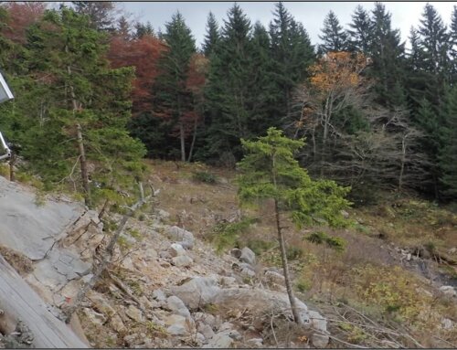
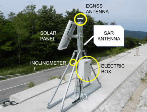
GIMS’s objective is to set up a new system (product + service) useful for landslide monitoring: the system will be actually tested in pilot area to evaluate its performances.
 Pilot areas will be chosen among the ones indicated by GeoZS, one of GIMS’s project partners.
The areas that could become GIMS’s test site are:
- Slano Blato landslide
- Geological settings: weathered flysch rocks close to tectonic contact
- Existing monitoring: weather station, system of cameras, geodetic points, suction probes
- Movement velocity: 1-2 cm/year, occasional/seasonal movements (up to few meters) during the extensive rainfall events in the upper part of the landslide
- Motorway H4 Razdrto-Vipava
- Geological settings: carbonate scree deposits, weathered flysch rocks close to tectonic contact
- Existing monitoring: inclinometers, geomechanical boreholes
- Movement velocity: 1-2 cm/year, occasional/seasonal movements during extensive rainfall events
- Landslide Laze
- Geological settings: clastic soft rocks
- Existing monitoring: LIDAR in years 2005 and 2014, 8 boreholes between 2014 and 2016, 10 piezometers, 103 geodetic points (established in years 2016 and 2017)
- Movement velocity: 5 – 10 cm/year, the highest velocity is during the extensive rainfall events
- Landslide Boršt
- Geological settings: clastic soft rocks
- Existing monitoring: geodetic network, PSInSAR between 1992 – 2001, inclinometers, mapping, piezometers
- Movement velocity: landslide was activated in 1990 after heavy rainfall and velocity was 0.5 m/year, after the first remediation in 1995 the velocity was 25 mm/year
- Landslide Čemšenik
- Geological settings: Triassic carbonate rocks thrusted over Upper Carboniferous and Permian clastic rocks. Part of the area is covered with large quantities of talus and scree material
- Existing monitoring: geotechnical and hydrological monitoring: inclinometers, piezometers, geodetic measurements of object points located on the church
- Movement velocity: 1 cm/year (dry seasons); 2 cm/year (wet seasons)
- Landslide Macesnik
- Geological settings: Permian/Carboniferous clastic rocks, Triassic carbonate rocks
- Existing monitoring: inclinometers, piezometers, geodetic measurements
- Movement velocity: 2-3 cm/year (after 2017 remediation) Endangered objects: Solčava village, road infrastructure
- Landslide Šmihel Location
- Geological settings: Permian/Carboniferous clastic rocks, Triassic carbonate rocks
- Existing monitoring: 12 inclinometers (in years 2001 – 2007)
- Movement velocity: 1 cm/year Endangered objects: 6 residential houses
The rationale to choose two pilot sites for the GIMS project will be based on the following parameters:
- characteristics compatible with GNSS and SAR site requirements;
- expected movement velocity (one slow-moving and one moderate- or fast-moving landslide);
- availability of pre-existing monitoring equipment/results;
- good 3G connectivity to ensure reliable data transfer.

