Eugenio Realini and Daniele Sampietro of GRed – GIMS project coordinator, present GIMS in a Poster Session at the conference MEd 2018, organised by ESA -ESRIN in Frascati, Italy to define a roadmap for a Mediterranean initiative within ESA’s EO Science for Society Programme Element, encompassing topics such as atmosphere, oceanography, climate and land research and applications.
The Mediterranean Sea region is surrounded by 22 countries, which together share a coastline of 46000 km. About 250 million people resides in coastal hydrological basins and a 50% population growth was reported in 20 years at the end of the 90’s. Fragility and vulnerability of the Mediterranean system is well known and since the 70’s international efforts are ongoing to protect it. In this context, Earth Observation (EO) represents an opportunity for innovative science, applications and information services to face some of these issues as well as a potential catalyser for innovation and growth in the region.
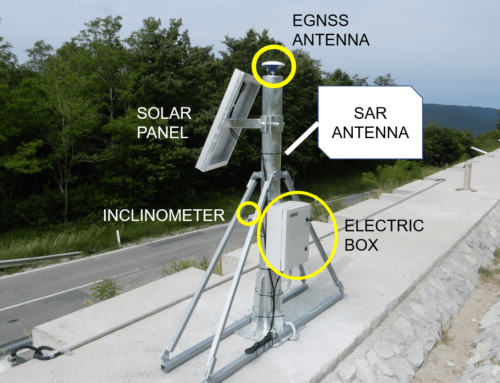
GIMS is an innovative low-cost system to monitor ground deformations based on EGNSS, Sentinel InSAR and Inertial Measurement Units: this is the latest innovation within the land research domain applied to geodesy. It can surely give its contribution to discuss and agree on a number of key priority areas and requirements for research and development activities that may address the science and applications needs of a wide range of user sectors in the region and prepare a roadmap to be implemented in the ESA EO Science for Society Programme Element. These are indeed the objectives of the Conference.


